
Explore Coastal Fishing Maps – GPS Maps for East & Gulf Coasts
The fishing GPS maps categorize locations into the NE Atlantic, Mid Atlantic, SE Atlantic, Florida Atlantic, Florida Gulf, and the Gulf Coasts, highlighting popular GPS fishing locations.
Click on NE Atlantic, Mid Atlantic, SE Atlantic, Florida Atlantic, Florida Gulf, and Gulf Coast to discover local maps by category, including valuable fishing GPS maps that help you find the best GPS fishing locations.
Find Your Next Hot Spot with Our Fishing GPS Maps. Start Fishing Smarter Now!
Our mission is simple: help anglers find more fish, faster, using professionally built fishing GPS maps that highlight productive GPS fishing locations. Every map is designed to save you time scouting, eliminate guesswork, and make every fishing trip more successful.
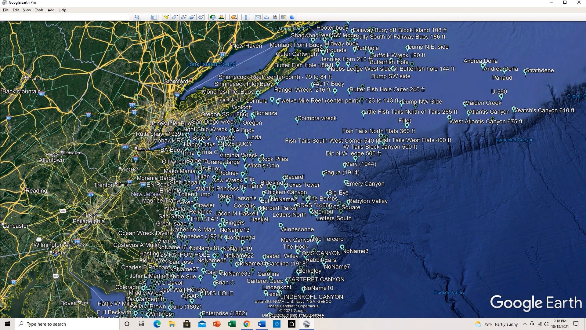
Fishing Inmaps offers detailed fishing GPS maps for anglers seeking fishing GPS locations targeting wrecks, reefs, ledges, and canyons along the East Coast and Gulf Coast. Explore the best offshore and inshore GPS fishing maps for both coasts.
Welcome to Fishing Inmaps, your go-to resource for accurate, up-to-date digital GPS fishing maps specifically designed for the East and Gulf Coasts. Whether you’re targeting inshore species or venturing offshore, our fishing GPS maps provide you with productive fishing spots, reefs, wrecks, ledges, and underwater structures — all formatted for easy use on your GPS devices.
Fishing Inmaps offers downloadable GPS fishing waypoints for anglers looking to explore offshore and inshore fishing locations along the entire East Coast and Gulf Coast — from Maine to Texas. Say goodbye to manually entering coordinates; you can import hundreds of verified GPS fishing locations in seconds.
Q: What GPS devices are your fishing maps compatible with?
A: Our GPX files are compatible with all major GPS and chart plotter brands, including Garmin, Simrad, Lowrance, Furuno, Raymarine, and Humminbird. We also provide KML files for Google Earth and Excel spreadsheets.
Q: How do I download and install GPS fishing waypoints?
A: After your purchase, you'll receive a digital download link. You can easily import the GPX file directly to your GPS chart plotter or SD card — no manual entry required. Full instructions are included.
Q: What areas do your fishing maps cover?
A: Our fishing GPS maps cover the entire East Coast from Maine to Florida and the full Gulf Coast from Florida through Texas, including both offshore and inshore fishing spots.
Q: Do your fishing maps include inshore spots?
A: Yes — our maps feature both offshore and inshore GPS fishing waypoints, including reefs, wrecks, ledges, and nearshore structures.
Fishing Inmaps offers detailed fishing GPS maps for anglers seeking fishing GPS locations targeting wrecks, reefs, ledges, and canyons along the East Coast and Gulf Coast. Explore the best offshore and inshore GPS fishing maps for both coasts.
FISHING-Inmaps - Coastal Maps
support@inmapsfishing.com